Severe storms threaten travel in 4th of July celebrations across the south and northeast.
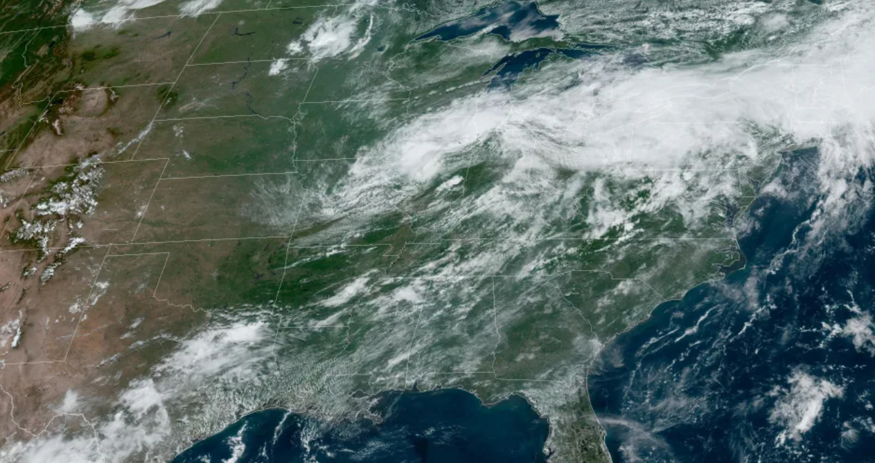
As the Fourth of July weekend continues, severe storms are set to head across a wide swath of the United States from New York and Pennsylvania to Arkansas.
On Sunday, 51 million people on the road are at risk of severe thunderstorms from afternoon to evening. The danger area includes Nashville and Memphis, Tennessee; Louisville, Kentucky; Philadelphia. Baltimore. Charlotte, North Carolina; and Washington, DC
The strongest storms will target Kentucky and Tennessee, which could bring damaging winds of over 65 mph and hail the size of a ping-pong ball—through a tornado or two can't be ruled out.
Scattered rain will continue throughout Sunday, with the strongest storms set to begin in Kentucky and Tennessee after 2 p.m. CT. The threat will continue into the evening and overnight as the line of storms moves into the Appalachian Mountains.
Flooding has been reported in Clinton County, New York.
New York Gov. Kathy Hochul said rainfall over the past 12 hours had resulted in dangerous conditions in certain areas.
"I am closely monitoring the situation and have directed my team to assist local officials however necessary. We have already deployed staff with the state Office of Emergency Management to monitor the situation and provide support to local leaders," Hochul said in a statement on Sunday.
In Chicago, heavy rain caused delays to NASCAR Street Race Weekend.
"We are in pattern waiting for #GrantPark220 until conditions improve," NASCAR tweeted Sunday night.
The storm system will hit the Carolinas and the mid-Atlantic region on Monday, affecting 29 million people in Philadelphia; Baltimore. And Charlotte and Raleigh, North Carolina. Wind damage, major hail, and a tornado would be possible.
As the Fourth of July holiday approaches, the Northeast and Southeast can expect scattered showers and temperatures in the 80s and 90s.
The Midwest and the Rocky Mountains may get rain, while the West will be sunny and dry, with temperatures of 70 to 100 degrees.
Heat alerts from coast to coast
About 63 million people from coast to coast remained under heat alerts Sunday afternoon, including those who live in Raleigh, Charlotte. Atlanta. Tallahassee, Florida; Montgomery, Alabama; New Orleans; Corpus Christi, Texas; Phoenix and Tucson, Arizona; Bakersfield and Sacramento, California; and Portland, Oregon.
Heat warnings were issued for the Mojave, Maricopa, Yuma, and eight other Arizona counties.
Over 30 records were threatened Sunday in cities across eight states: Tucson and Phoenix; Tampa and Jacksonville, Florida; Fresno and Palm Springs, California; New Orleans; and Asheville, North Carolina.
Temperatures in Tallahassee on Saturday reached 100 degrees, setting a record in 1990, according to the National Weather Service. In New Orleans, a heat alert was in effect Sunday.
"The temperature indicators are expected to reach 110," the weather service wrote on Twitter. "Exercise heat safety and take care of yourself!"
As with Saturday, highs in the Southeast were forecast to be in the high 90s, with heat index values close to 115 degrees. Fortunately, a short cold front was likely to help bring temperatures down near seasonal highs for the rest of the holiday week.
In the West, heat alerts will continue through Tuesday, with maximum temperatures ranging from 100 to 120 degrees in the afternoon. Temperatures will fall to or below average across California and Arizona for the second half of the week.
Authorities have recorded 18 heat-related deaths in the United States since June 11-18 in Webb County, Texas, and two in Caddo Parish, Louisiana.
Post a Comment